

-

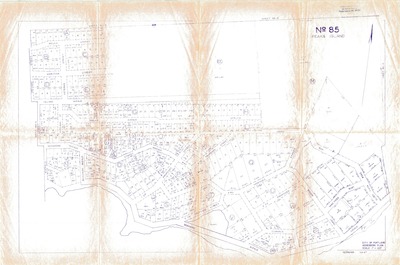
Land Use Map : Peaks Island, No.85
City of Portland Assessors
Northeaster section of Peaks Island, including roads and lots.
-

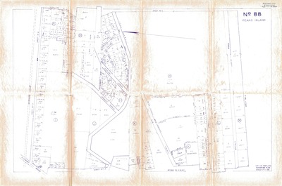
Land Use Map : Peaks Island, No.88
City of Portland Assessors
Central section of Peaks Island, including roads and lots.
-

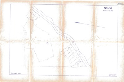
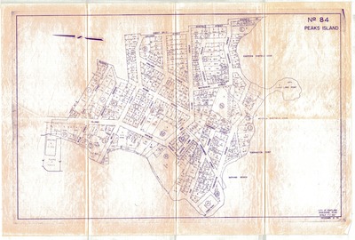
Land Use Map : Peaks Island, No.84
City of Portland Assessors
Southern section of Peaks Island, including streets and beaches.
-

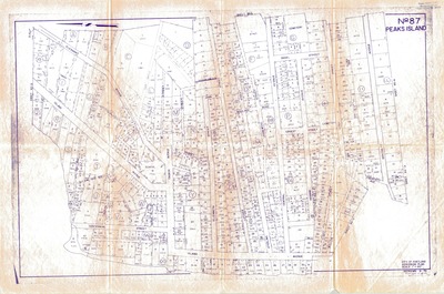
Land Use Map : Peaks Island, No.87
City of Portland Assessors
Western section of Peaks Island, including streets and lots.
-

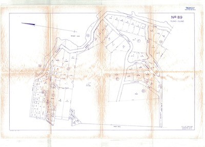
Land Use Map : Peaks Island, No.92
City of Portland Assessors
Northwestern portion of Peaks Island, including roads and lots. Knickerbocker Road, at right.
-

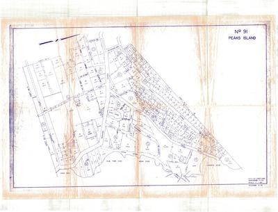
Land Use Map : Peaks Island, No.91
City of Portland Assessors
Northern portion of Peaks Island, including roads and lots. Reed Avenue at center.
-

City of Portland : Land Use Pamphlet, Supplement No. 18 - Oct 1989.
City of Portland, Maine
This supplement is a reprint of the changes in Chapter 14, Land Use, of the Code of Ordinances of the City of Portland, Maine, as they appear in Supplement No. 18 to the main volume.
-

Land Use Committee Forum : Feb 2006
Peaks Island Forum
Land Use Committee Meeting materials, from Peaks Island Forum meeting on February 25, 2006. Includes maps, photos, and charts documenting the physical characteristics and geography of the island, environmental conditions and limitations, demographics, and housing.
Printing is not supported at the primary Gallery Thumbnail page. Please first navigate to a specific Image before printing.

