

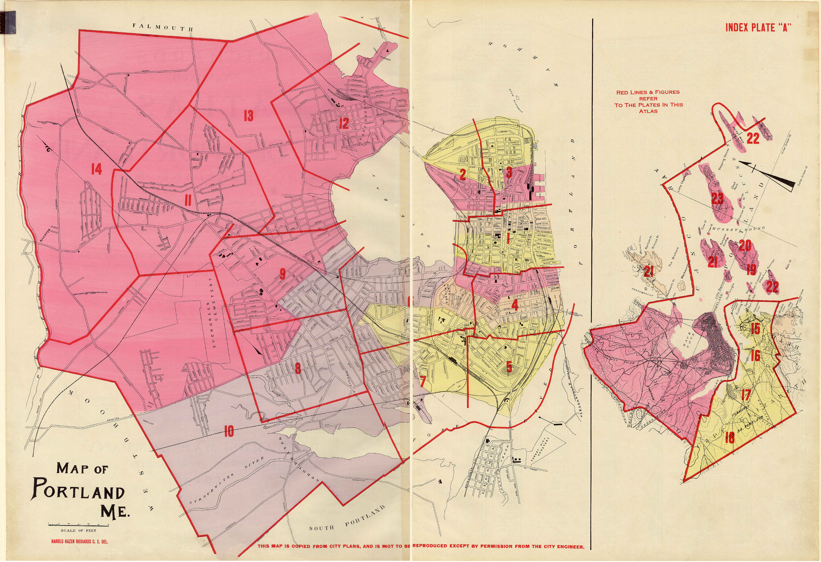
The Richards Standard Atlas of the City of Portland, including the City of So. Portland, Maine, containing 24 double page maps in color, documenting the entire city, showing each property's lot line, building, many owners' names, electric and steam railways, sewer lines, water mains, etc.
Areas of each lot in square feet and acres. Based upon and carefully compiled from, the official plans, surveys, and records of the City engineers, assessors and other municipal departments, together with private plans, and from actual surveys and investigations by the publishers' special corps of engineers. Under the personal direction of Harold H. Richards.
Richards Atlas citation in Portland Public Library catalogue. The original may be viewed for research in the Portland Public Library's Portland Room.
Interactive table of contents for the plates:
1) Downtown Portland, Bayside, Gorham's Corner, Portland Harbor
2) Munjoy Hill (north)
3) Munjoy Hill (south)
4) Parkside, West End (eastern section)
5) West End (western section)
6) Deering Oaks, Oakdale, Parkside
7) Libbytown, West End (western section)
8) Deering Center, Libbytown, Rosemont
9) Back Cove, Deering Center
10) Libbytown, Stroudwater
11) Allen's Corner, Morrill's Corner, North Deering
12) East Deering, North Deering
13) East Deering, North Deering, Presumpscot River
14) Riverton
15) South Portland: Ferry Village, Fort Preble, Willard Square
16) South Portland: Knightville, Mill Creek
17) South Portland: Ligonia, Pleasantdale
18) South Portland: Cash Corner, Fairmount
19) Peaks Island (southern section)
20) Peaks Island (northern section)
21) Great Diamond, Little Diamond Island, Mackworth Island, Falmouth Foreside
22) Cushing's Island, Cliff Island, House Island, Jewell's Island, Ram Island
23) Long Island