

-

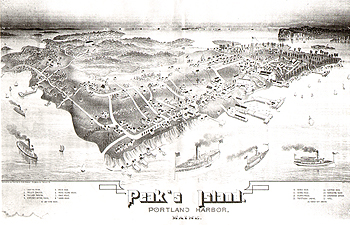
Casco Bay and Portland Harbor Steamboat and Ferryboat Route Chart.
Unknown
Map of steamboat and ferry routes in Casco Bay, with connections to Portland. Lists of Portland and Casco Bay island wharves, steamboat, ferry, and military steamer lines and their respective routes.
17 x 22"
-

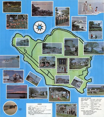
An Island of Easy Living : Peaks Island in Casco Bay, Maine.
Nor’ by East
Pictorial map of Peaks Island, showing landmarks, businesses, scenery, community facilities. Includes introductory notes about Peaks Island. Ca.1962.
Map printed on both sides. Verso includes color photos and ads for local businesses, the summer ferry schedule, and a brief history of the island.
Published by Nor’ by East, Island Development Association. Printed by Portland Lithograph Co. 16 x 18” -

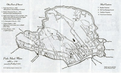
The Peaks Island History Trail
Fifth Maine Regiment
Broadside published by the Fifth Maine Regiment Community Center, with support from the Maine Humanities Council, describing historic Peaks Island landmarks, such as Battery Steele, The Dayburn Casino (Trefethen Landing), Greenwood Garden, and the Fifth Maine Regiment Community Center. Map includes points of historic interest and Island cemeteries.
Printed on both sides.
8.5 x 14" -

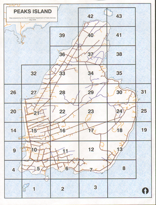
Peaks Island Maps, 2008.
Department of Public Services, Portland, Maine
Maps prepared by the City Of Portland's Department of Public Services, May 2008, showing location of hydrants and water and sewer lines on Peaks Island.
Printing is not supported at the primary Gallery Thumbnail page. Please first navigate to a specific Image before printing.